Soil Moisture Snap Shot April 2026
Dale Grey, Agriculture Victoria, Bendigo
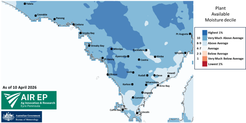
The BoM AWO modelled soil moisture decile for perennial pastures currently shows wetter than average values across the Eyre Peninsula. Much of the area is ranked decile 10 but the eastern coast is ranked decile 8 to 9.
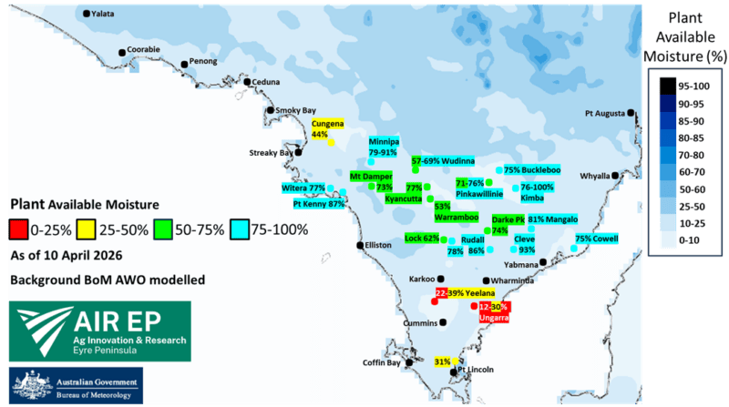
The modelled plant available moisture percentage map shows most areas could be as low as 10-25% if weeds, volunteers or pasture have been allowed to suck the profile dry unimpeded. The model has no idea that grain farmers are spraying paddocks out, and hence the AIR EP soil moisture probe network shows values higher than those modelled. A lot of the northern EP shows values greater than 75% full and this decreased to less than 50% in the south.
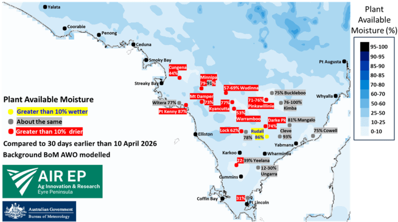
Many northwestern paddocks have decreased significantly from being at or close to fully wet up a month ago. In light sandy soil there has been a degree of deep drainage, in conjunction with the sun evaporating the surface and probably some plant water use before weed control occurred. Of those drying sites, the median moisture decrease was 17 percentage points but ranged from -1 to -56 percentage points. The Rudall site increased by 20 percentage points, but this has been a steady response after the initial rainfall event appearing like slow percolation from surface to deeper layers.
This information has been provided as part of the Sustainable Agriculture EP project which is supported by the Australian Government through funding from the Natural Heritage Trust under the Climate-Smart Agriculture Program and delivered for the Eyre Peninsula Landscape Board, a member of the Commonwealth Regional Delivery Partners panel by AIR EP, EPAG Research, PIRSA and Ag VIC.
![]()