Climate update for the Eyre Peninsula
by Dale Grey, Seasonal Risk Agronomist, Agriculture Victoria, Bendigo
The eastern Pacific Ocean surface has been slowly warming over the last six weeks in line with the very warm undersea which is in a pre El Niño like state. History says this doesn’t guarantee formation of one. Despite a rapid fall in the SOI during April into El Niño territory, this is now tracking back to neutral, indicative of no atmospheric support for an El Niño yet. Most models are predicting an El Niño to form and stay active for the growing season. In the last 15 years models are about 50:50 for getting it right at this time of the year. Remembering that in the past, El Niños have resulted in dry decile 1 seasons around 20% of the time, they don’t equal drought. Look for stronger westerly winds north of the Solomon Islands as an indicator that something might be starting.
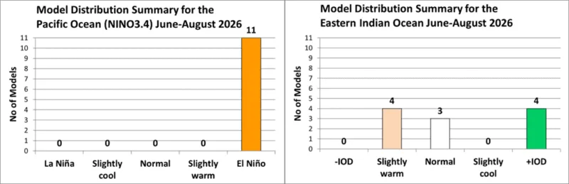
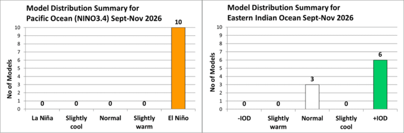
Model interest in a +IOD has waned somewhat this month, particularly for winter, with enthusiasm picking up again in spring. At the moment there is not a single indicator for the formation of a +IOD. IOD events can form in 4 weeks if the right winds occur. Look for stronger easterly winds off Sumatra as an indicator something might be starting.
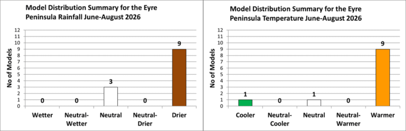
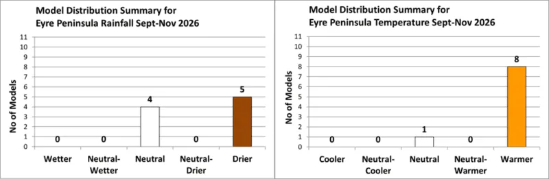
Most models continue to predict a drier and warmer winter, but this is mostly predicated on an El Niño forming. Historical model accuracy for winter rainfall prediction on the EP is poor to moderate.
Higher air pressure has picked up as the current bogie for drier conditions, with just enough gap between highs currently, to allow some rain through. Models are predicting pressure to increase to the southwest and over the Indian Ocean in coming months.
![]()